Same process ...


And here's what we have so far:


And in one video:
Same process ...
And here's what we have so far:
And in one video:
Today, I didn't have time to continue on building draft structures, so I focused on pictures of the facades.
See below:
 |
| 11 rdM #111 - 11 rue des Martyrs - Parcelle 111 |
 |
| 13 rdM #110 - 13 rue des Martyrs - Parcelle 110 |
 |
| 15 rdM #109a - 15 rue des Martyrs - Parcelle 109 |
 |
| 15 rdM #109b - 15 rue des Martyrs - Parcelle 109 |
For this last one, I had to combine two pictures together since the house is quite tall. I fixed the perspective and dimensions on each of them before combining them and the fit is very good.
Now that the tracks are glued and wired, it's probably time to start thinking about the scenery. The first stage is ballasting and track weathering, but I need to do a bit of research on this to decide how to proceed. The second stage is to start drawing the outline of the streets and building and to decide the exact location.
The main issue here to have an outline at the exact scale. Here's my current thinking:


 |
| Google Street View |
 |
| My photo |


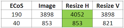
In a previous post, I provided links to videos that showed how to load an image into the ECoS. This post is about using Gimp to handle rotation, resizing, adjusting background, and exporting.